

Geography
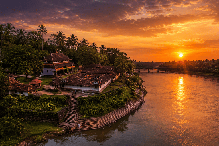
Thirumittacode Grama Panchayat is located in the Pattambi Taluk of Palakkad district. Situated along the banks of the Bharathapuzha River, this region is renowned for its natural beauty and cultural heritage.
The Thirumittacode Grama Panchayat comprises the villages of Thirumittacode-1 and Thirumittacode-2. Its wards fall under four Block Panchayat divisions (Thirumittacode, Karukaputhur, Peringode, and Kootanad) within the Thrithala Block Panchayat, as well as two District Panchayat divisions (Chalissery and Kappur).
The panchayat covers an area of 32.31 square kilometers and is situated in the western part of Palakkad district. Its boundaries are defined by Thrithala Panchayat to the north; Kadungode and Erumapetty Panchayats to the south; Varavoor and Desamangalam Panchayats to the east; and Nagalassery Panchayat to the west. According to the 2011 census, the total population was 32,032; current estimates place the population at over 36,000. Broadly speaking, the panchayat's landscape consists of hills, associated wetlands, and valleys; it also features a 1,250-meter stretch along the banks of the Bharathapuzha River. The panchayat is served by a network of rural roads spanning 180 kilometers and PWD roads covering 30 kilometers.
The forests and hills of Kadungode mark the southern boundary of the grama panchayat. Notable hills in the area include Meleppura Kunnu, Malayakam Kalluvay Kunnu, Chemprakunnu, Erankunnu, Edappattakunnu, Pindali Kunnu, Thorakunnu, Ottuparakunnu, Kadenkarakunnu, and Chalachikunnu. The southern region of the panchayat slopes towards the southeast and southwest. Water flows from the northeastern part of the panchayat towards the west and north. Approximately 80% of the rainwater falling within the panchayat drains into the Bharathapuzha River at Thirumittacode. Laterite and granite are abundant in the hilly areas, while the paddy fields and low-lying regions feature grey-colored soil containing about 5% sand and possessing good water-retention properties. Some paddy fields contain black, sandy clay soil. There are negligible marshy areas in the Nellikkattiri region. Clay suitable for pottery making is found in areas adjacent to the river.
The Panchayat has specifically cataloged the soil characteristics of the plains, foothills, and elevated areas.
**Geographical Location**
The northern part of Thirumittakkode Panchayat generally comprises the banks of the Bharathapuzha River.
Small hills, agricultural lands, and rural settlements are spread across the southern region.
It has road connectivity to areas such as Pattambi, Shoranur, and Ottapalam.
The terrain consists of plains situated at a low elevation above sea level.
**Rivers and Water Sources**
The Bharathapuzha River is the primary natural feature defining the landscape of the Panchayat.
The river flows abundantly during the monsoon season.
Sandy stretches and lush green agricultural fields can be seen along the riverbanks.
The Bharathapuzha River provides significant support for irrigation and agriculture.
**Climate**
The region experiences a tropical climate.
Heavy monsoon rains occur from June to September.
Although temperatures rise during the summer, the areas along the riverbanks remain relatively cool.
**Topography and Soil Type**
The landscape consists primarily of plains.
Alluvial soil is predominantly found along the riverbanks. The soil is suitable for the cultivation of paddy, coconut, banana, and vegetables.
Flora and Agriculture
Key crops include paddy, coconut, banana, and mango.
Wetlands and small backwaters are found in the rural areas.
Lush green tree lines along the riverbanks enhance the beauty of the region.
Cultural and Geographical Characteristics
The Thirumittacode Anchumoorthy Temple is one of the panchayat's major cultural centers. The temple and the Bharathapuzha River together lend a unique geographical and cultural identity to the area.
In short, Thirumittacode Panchayat is an eco-friendly rural region characterized by riverbank plains and agriculture; the Bharathapuzha River serves as the lifeline of the area.


