

Ward Map
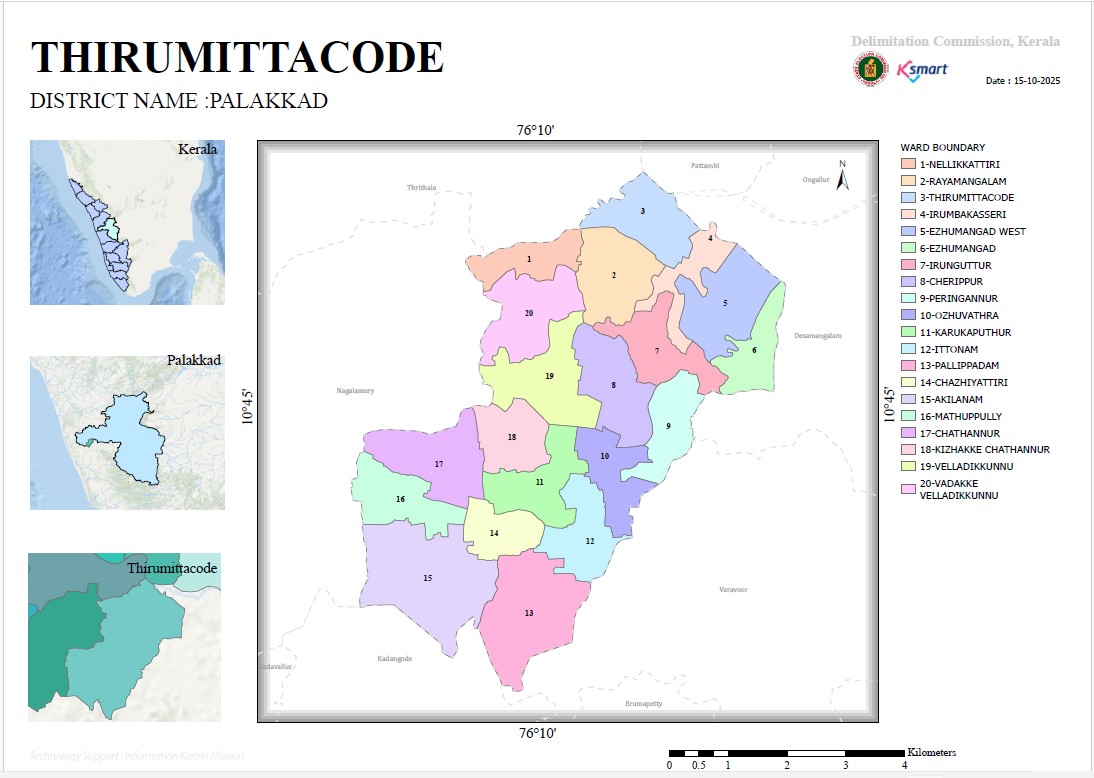
This is the official ward map prepared for Thirumittacode Grama Panchayat as part of the 2025 ward delimitation process for local self-government institutions in Kerala.
You can view the details regarding the panchayat's ward boundaries, roads, water bodies, key landmarks, and administrative areas by using the link provided below.
This digital map helps the public understand ward boundaries and check area-specific information. Features such as zooming in, exploring various areas, and locating specific places are also available.


